In this Sky News Australia special report, meteorologists Rob Sharpe and Alison Osborne unpack predictive data which paints a sombre picture of the country’s severe weather outlook from October of this year to April 2023.
The last severe weather season was marked by flooding rain in the east and exceptional heatwaves on the west coast, but large parts of Australia didn’t see much extreme weather.
This year will be different.
Sky News Australia predicts every part of the country will face an increased risk of at least one severe weather phenomenon.
EASTERN AUSTRALIA BRACING FOR MORE WET WEATHER
Flooding is shaping up to be the single greatest risk to Australians.
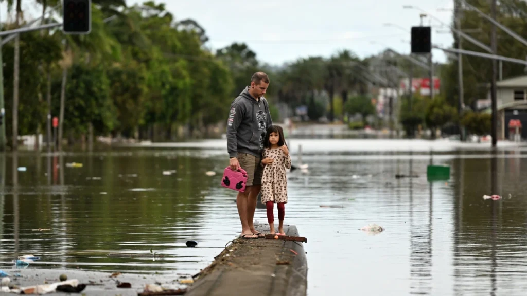
It follows a period of devastating floods across south-eastern QLD and eastern NSW, with the most extreme case being the Northern Rivers at Lismore where several people died, and hundreds lost their homes.
Areas in blue have seen above normal rainfall in the past 8 months with record rain in the darkest blue, including parts of Brisbane and Sydney.
Therefore, at the start of this severe weather season dams, soil and rivers contain more water than at the same time last year.
The outlook for rainfall looks similar with three climate drivers, including La Niña, all aiding wet weather in eastern Australia.
Therefore, with a wetter starting point and a similar outlook, we predict more widespread flooding than last year – with the greatest threat in QLD, NSW and VIC.
The Murray-Darling Basin is likely to see its worst floods in half a century.
The basin extends from Queensland’s southern interior, through inland NSW to northern VIC and south-eastern SA.
Dams are averaging 96 per cent across the basin – many at capacity -and it is exceptionally wet underfoot with significant and prolonged flooding along several rivers.
We predict that water flows through the system will exceed those of 2016 and 2011 to produce the worst floods since 1974.
In northern Australia, this year’s tropical cyclone season has the potential to be the most active in 17 years. Last year ten tropical cyclones were named in Australian waters, but only two made landfall.
This year we’re forecasting between ten and 13 cyclones to form in Australian waters. Our best estimate is that four or five should make landfall.
THE LAND OF FIRES AND FLOODS
Despite all the rain and cyclone activity, much of Australia is still likely to be hotter than usual. Heatwaves are more likely than usual in the west and along the southern coastline.
In central Australia, there is an increased risk of out-of-control grassfires due to high fuel loads and the potential for hot weather to dry out the landscape quickly if there is a decent gap between rain events.
Finally, severe thunderstorms are a lesser risk than usual across eastern Australia due to the prevalence of rain events instead of storm outbreaks.
However, in southern, central and western Australia, two crucial ingredients for storms – extra moisture and heat, are likely to produce more severe thunderstorm activity than usual.
Therefore, putting it all together, almost nowhere across Australia is heading into the coming months without an elevated threat of some form of severe weather this season.
LA NINA, RAINFALL AND CLIMATE
La Nina has redeveloped in the Pacific Ocean, but it is not the only influence on our current weather patterns.
There are two other climate drivers that are currently active and will play a role on our severe weather season and they are all pointing to extra rain in eastern Australia.
The most talked about is La Nina.
We declared La Nina had returned to the Pacific Ocean for the third year in a row just over a month ago. We anticipate it to be active through spring and early summer.
Unlike last season it should be gone by March.
During spring, La Nina increases rainfall potential across northern, central and eastern Australia, whilst through summer it’s influence contracts to the eastern half of the continent with the strongest influence on Queensland.
Similar to last year another negative Indian Ocean Dipole (IOD) event is underway, although this time its stronger than last year.
These events typically increase rainfall across northern, central and eastern inland Australia through spring, but it has almost no influence on summer rainfall as it typically ends on the transition of the seasons.
Finally, a third and rarely talked about climate driver should be active this severe weather season.
The Southern Annular Mode (SAM) is the north and south movement of the ring of westerly winds blowing around Antarctica.
When those winds contract towards Antarctica in its positive phase it usually leads to fewer cold fronts in the south and more easterly winds bringing rain to the east.
Strangely enough, the underwater volcano that erupted in Tonga and sent a massive plume of smoke and water into the atmosphere in January could lead to a fairly dominant positive SAM through spring and summer. We may explain that weird relationship on another day.
When considering all of these climate drivers together across the severe weather season we are confident that much of Australia will be wetter than usual, particularly in the east and the north.
The map above shows our forecast, which is slightly stronger for rainfall than at the same time last year.
Through the rest of spring much of northern, central and eastern Australia is likely to be wetter than usual. However, during summer the strongest influences will be in the northeast and the southeast of the country.
Some areas are likely to be drier than usual, mainly in western parts of Tasmania and southwestern WA, primarily due to the fewer than usual cold fronts expected.
Among our capital cities, Sydney has the greatest chance of seeing above normal rainfall, but Canberra, Darwin, Brisbane and Melbourne are not far behind. The other capitals should be near average.
A STORMY SEVEN MONTHS TO COME
In recent years Australia’s tropical cyclone seasons have been a bit quieter than usual, but this year it could be nasty and start early.
During the last tropical cyclone season, ten systems moved through Australian waters – one below the long-term average.
Among those, only Tiffany and Anika made landfall, which was below the average of four coastal crossings a season.
It may seem counter-intuitive given the higher occurrence of extreme weather events attributed to climate change, but a heated atmosphere actually reduces the likelihood of tropical cyclones.
That’s because their development depends on a temperature gap between a warmer tropical ocean and a colder atmosphere.
Since 2000, Australia has averaged nine tropical cyclones compared to the historical norm of 11.
That said, this year all the ducks are in a row for a more active than usual season.
We have an active La Nina, a negative Indian Ocean Dipole and the waters to the north of Australia are warmer than usual.
Despite the long-term decline in cyclones, we are forecasting between ten and 13 cyclones – the most since 2005 and 2006.
Our best estimate is that four or five should make landfall.
In the map above you can see we are forecasting between three and six tropical cyclones in the Coral Sea compared to last year’s three, while in the northern and western regions we are predicting a similar number to last year, but with more landfalls likely on the WA coastline – Australia’s usual cyclone hot-spot.
The first tropical cyclone that forms in Australian waters this season will be called Darian and has a higher-than-normal chance of forming in November.
The wet season will not merely be marked by extra tropical cyclones – rains have started earlier and are likely to be more prolific.
While the wet season officially starts on October 1, “rainfall onset” is declared in northern Australian towns when they reach 50mm after the first of September.
Parts of the north tropical coast and tablelands have already hit that mark in under a week.
Across the rest of the tropics it usually takes significantly longer. This year however, most areas across QLD and the NT should hit 50mm earlier than usual.
The north Australian monsoon is the arrival of the wet season’s heaviest rains, thanks to moisture-laden winds from the Indian Ocean and South Asia.
Our monsoon usually arrives a few times through the wet season, bringing widespread regions of heavy rainfall to much of northern Australia, often associated with tropical cyclones.
On average the first monsoon burst reaches Darwin on Christmas Day.
However, during La Nina events the first monsoon often arrives a week or two earlier near the middle of December.
Therefore, Darwin faces a slightly higher than usual chance of an early monsoon, increasing the chance of a wet and gloomy Christmas Day.
Overall, Northern Australia’s wet season is likely to be wetter than usual, particularly in the Queensland tropics driven by La Nina.
Residents therefore need to be prepared for the risk of flash flooding, while those in low-lying areas need to be on alert for rivers breaking their banks.
Finally, with the added cyclones this year, it is extremely important to have your cyclone kit prepped and ready to go.
Regardless of where you are in Australia, you face an increased risk of at least one form of severe weather during the coming seven months.
Watch Sky News Weather on channel 601 on Foxtel to get Australia’s most up to date and comprehensive weather news and severe weather coverage across the season so that you stay informed.
Read the full article here


